UN
26 Heene Way
£ 595,000
Description
We don't have a Description for this property.
- Bedrooms
- 4
- Bathrooms
- 0

Leaflet © OpenStreetMap contributors
The heatmap indicates the level of crime in the area. The color of the heatmap indicates the crime severity and recency.
Metrics Year-on-Year
- Average area value
- 303,278.00 £Increased by 4.08 %
- Average area rental value
- 1,178.00 £/moDecreased by 4.31 %
- Est rental Yield
- 4.66 %Decreased by 8.09 %
- Crime Rate
- 4.00 %Unchanged by 0.00 %
from 291,380.00 £
from 1,231.00 £/mo
from 5.07 %
from 4.00 %
Nearby Schools
| Name | Type | Ofsted | Distance |
|---|---|---|---|
| Heene Cofe Primary School | Voluntary Aided School | Requires improvement | 1.16 KM |
| St Mary'S Catholic Primary School | Academy Sponsor Led | Good | 1.21 KM |
| Our Lady Of Sion School | Other Independent School | 1.37 KM | |
| Elm Grove Primary School, Worthing | Community School | Good | 1.42 KM |
| Footprints Children And Family Centre | Children's Centre | 1.44 KM |
Images
Nearby Streets
| Name | Average Price | Average Sqft | Distance |
|---|---|---|---|
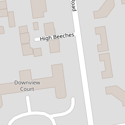
| High Beeches | £ 515,000 | 0 | 0.00 KM |
| Lansdowne Road | £ 360,000 | 0 | 0.00 KM |
| Tennyson Road | £ 0 | 0 | 0.00 KM |
| Norfolk Street | £ 0 | 0 | 0.00 KM |
| Rectory Road | £ 0 | 0 | 0.00 KM |
Nearby Transport
| Name | NLC | TLC | Distance |
|---|---|---|---|
| West Worthing | 5278 | WWO | 0.86 KM |
| Worthing | 5279 | WRH | 1.66 KM |
| Durrington-On-Sea | 5282 | DUR | 2.53 KM |
| East Worthing | 5283 | EWR | 3.98 KM |
| Goring-By-Sea | 5272 | GBS | 4.88 KM |
Nearby Listings
| Address | Price | Type | Score | Distance |
|---|---|---|---|---|
| St. Michaels Court, Worthing, BN11 | £ 265,000 | BUY | Unknown | 0.06 KM |
| Heene Way, Worthing, West Sussex, BN11 | £ 900,000 | BUY | Unknown | 0.10 KM |
| Downview Road, Worthing, BN11 | £ 325,000 | BUY | 7 / 10 | 0.11 KM |
| St. Michaels Road, Worthing | £ 895,000 | BUY | Unknown | 0.13 KM |
| Boundary Road, Worthing, BN11 | £ 600,000 | BUY | Unknown | 0.15 KM |
Nearby Properties
| Address | Price | Distance |
|---|---|---|
| 31 Heene Way | £ 490,001 | 0.00 KM |
| 10 Heene Way | £ 350,000 | 0.00 KM |
| 28 Heene Way | £ 425,000 | 0.00 KM |
| 21 Heene Way | £ 385,000 | 0.00 KM |
| 9 Heene Way | £ 465,000 | 0.00 KM |